


1950s Bartholomew's Map of Wharfedale
1950s Bartholomew's Map of Wharfedale
Couldn't load pickup availability
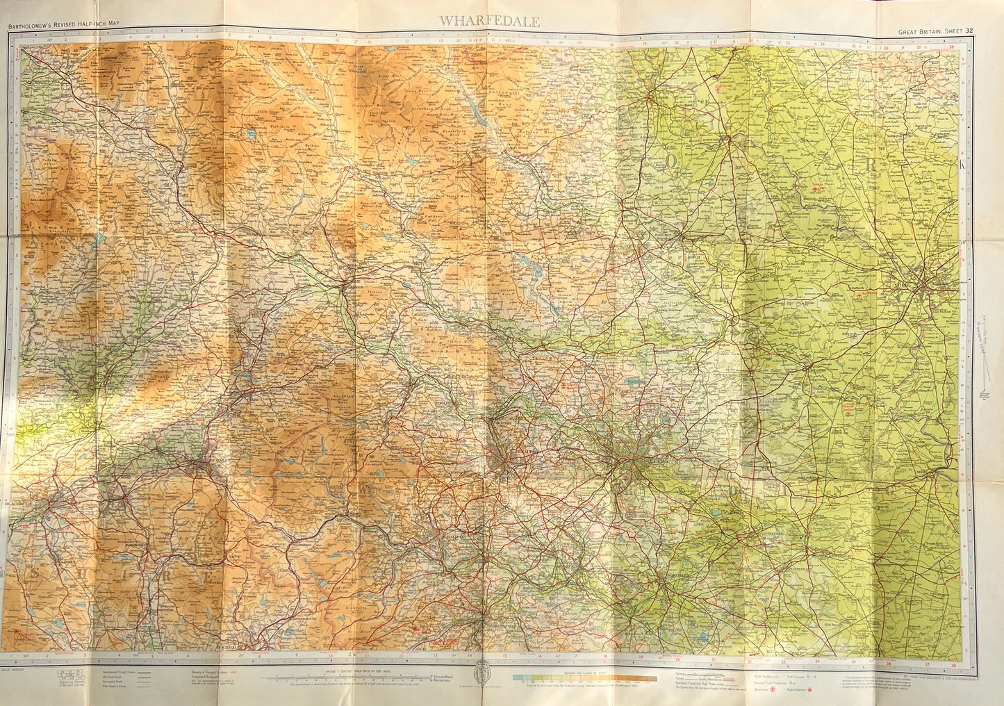
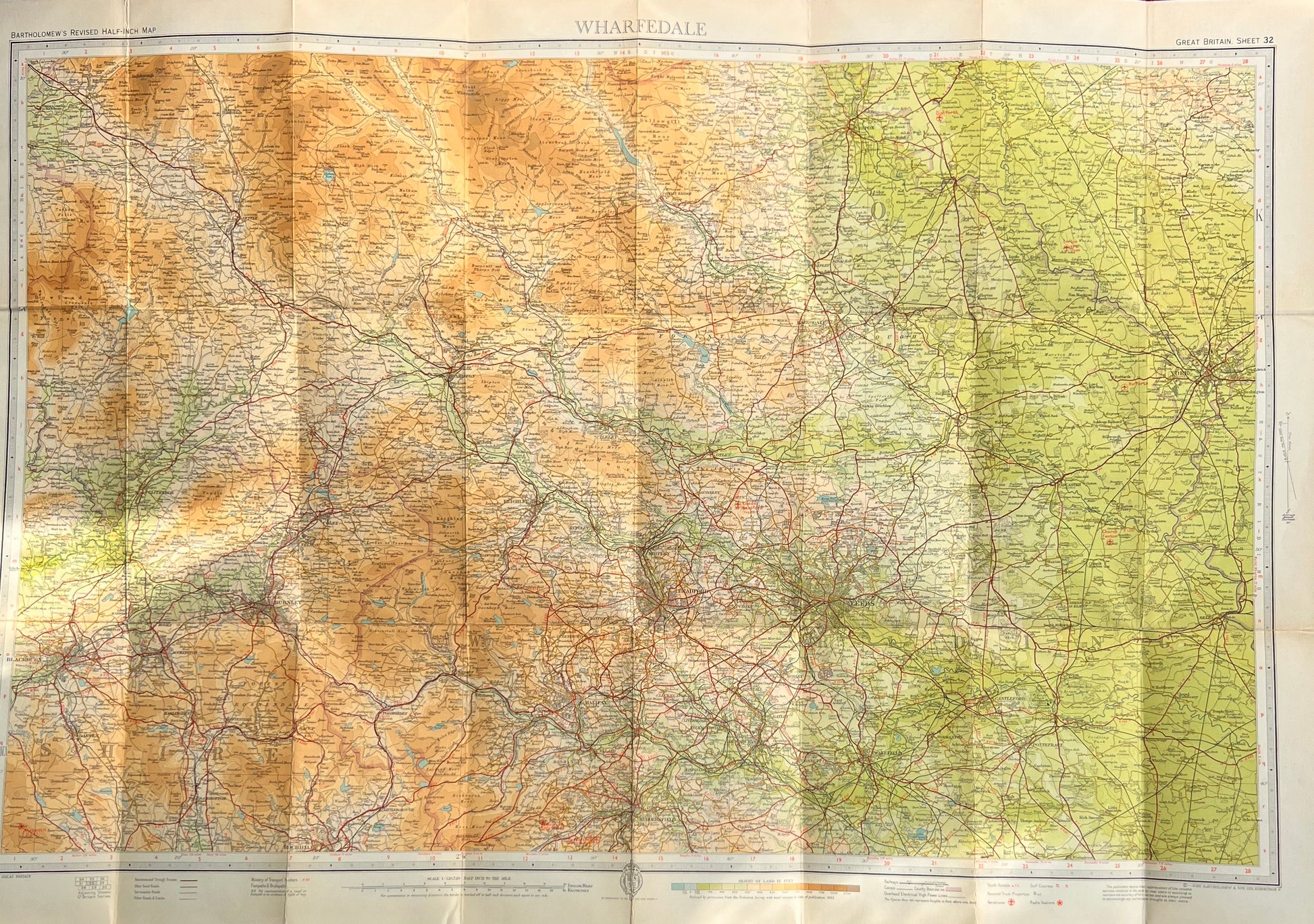
Bartholomew’s Revised Half Inch Contoured Map of Wharfedale Sheet 32
Scale Half Inch to a Mile
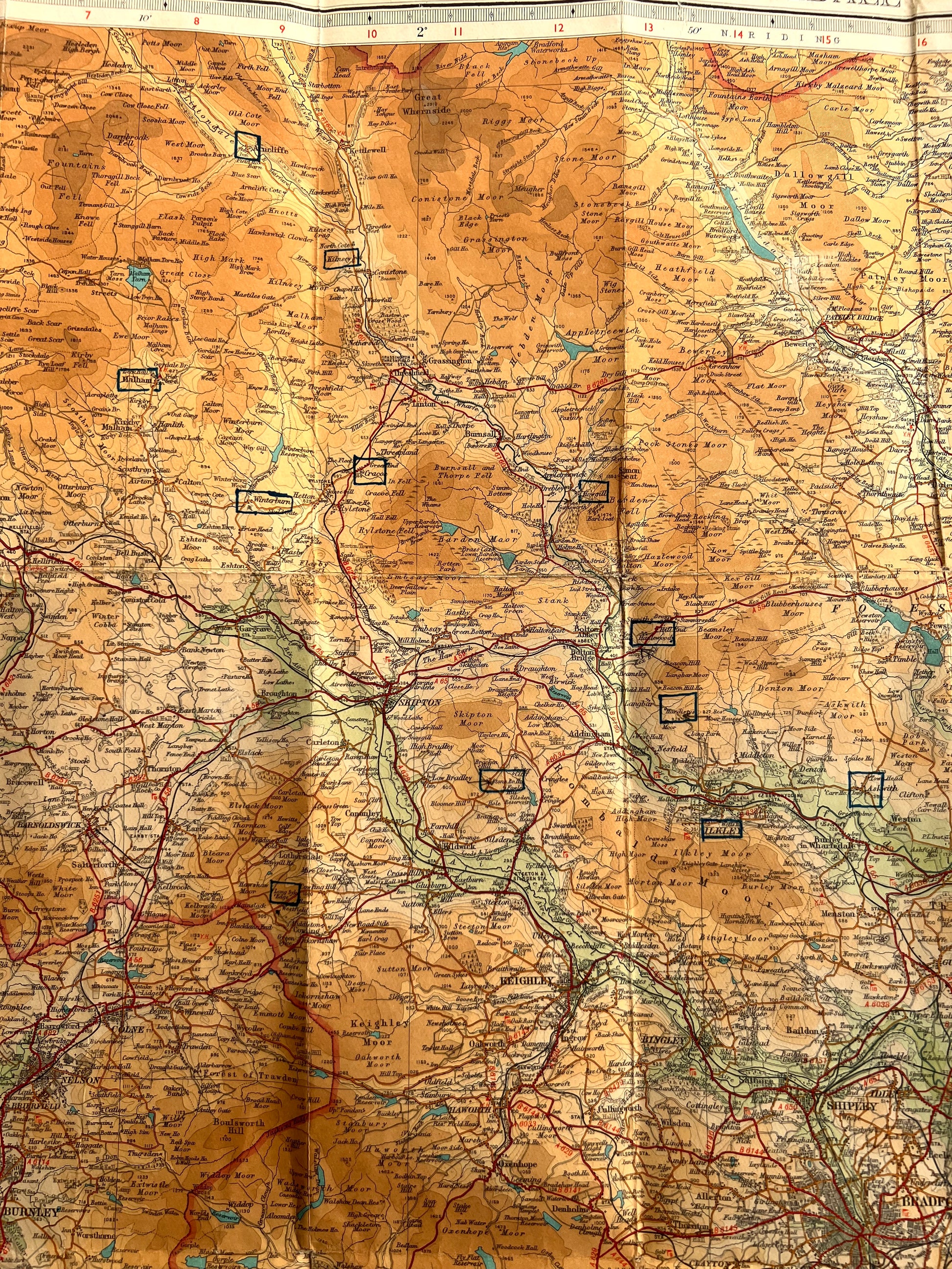
INGLETON to YEARSLEY along the top.
EGGERTON, to HUDDERSFIELD to ASKERN and MOSS on the bottom.
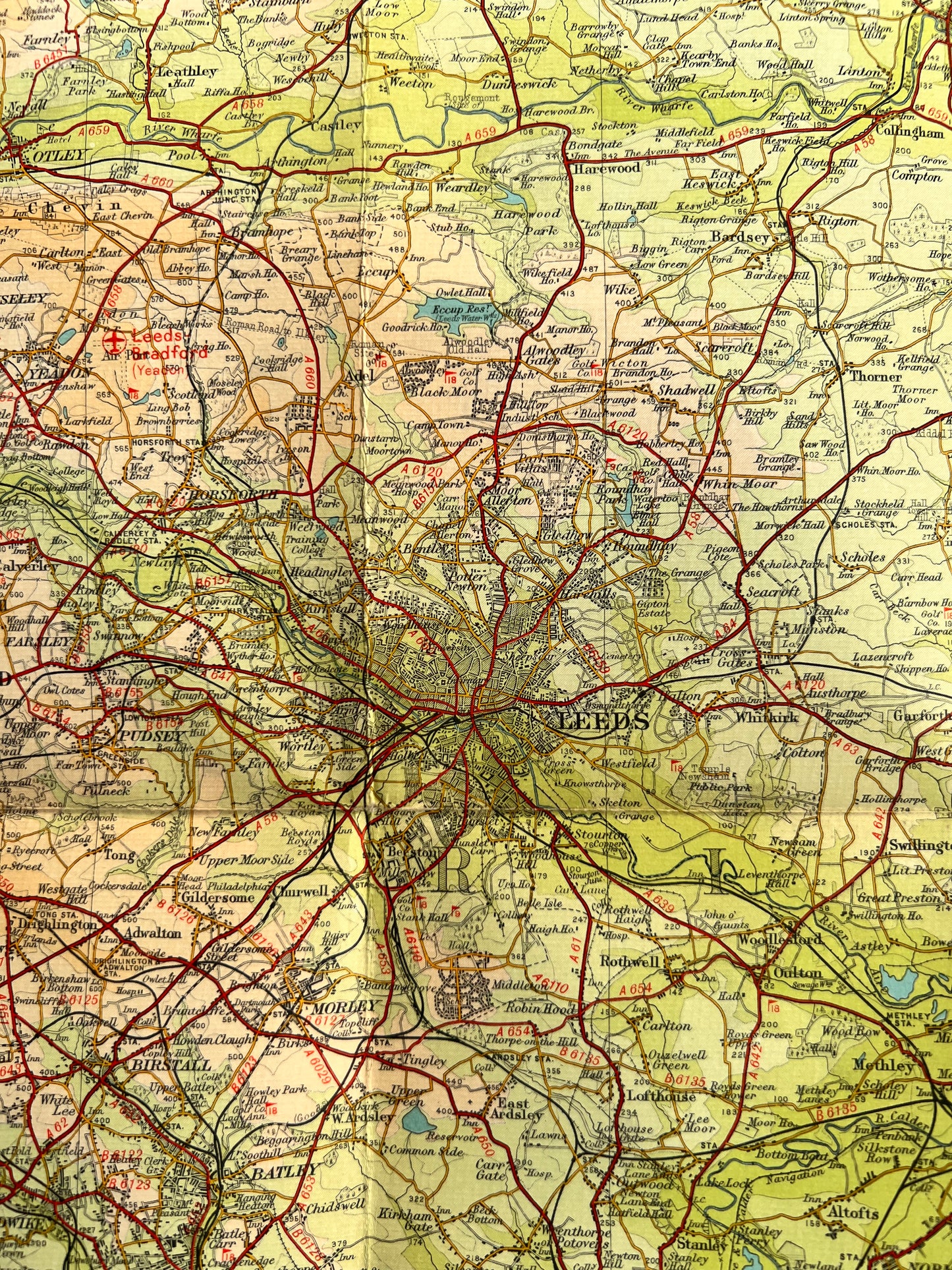
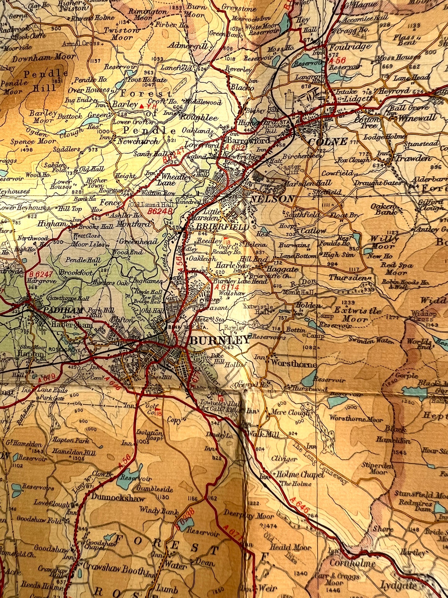
Including SETTLE, BURNLEY, SKIPTON, HARROGATE, RIPON, YORK, LEEDS, BRADFORD, KEIGHLEY, HALIFAX, DEWSBURY and WAKEFIELD.
Lots of fascinating details, long gone railways, radio stations, hospitals, stately homes and inns
I have 6 copies of this map - obviously a much visited area !
1. Published 1962. On cloth. Excellent condition.
2.Published 1946. On cloth. Fairly good condition, a few hole at joins of folds.
3.Published 1951. On cloth. Very good condition inside, slight wear on cover.
4.Published 1951. On cloth. Good condition - some village and towns outlined - visited perhaps (a challenge - recreate this person's journey...?)
5. Published 1951. On Paper. Very Good condition.
6. 1940s/50s. On cloth. Worn along folds and joins.