
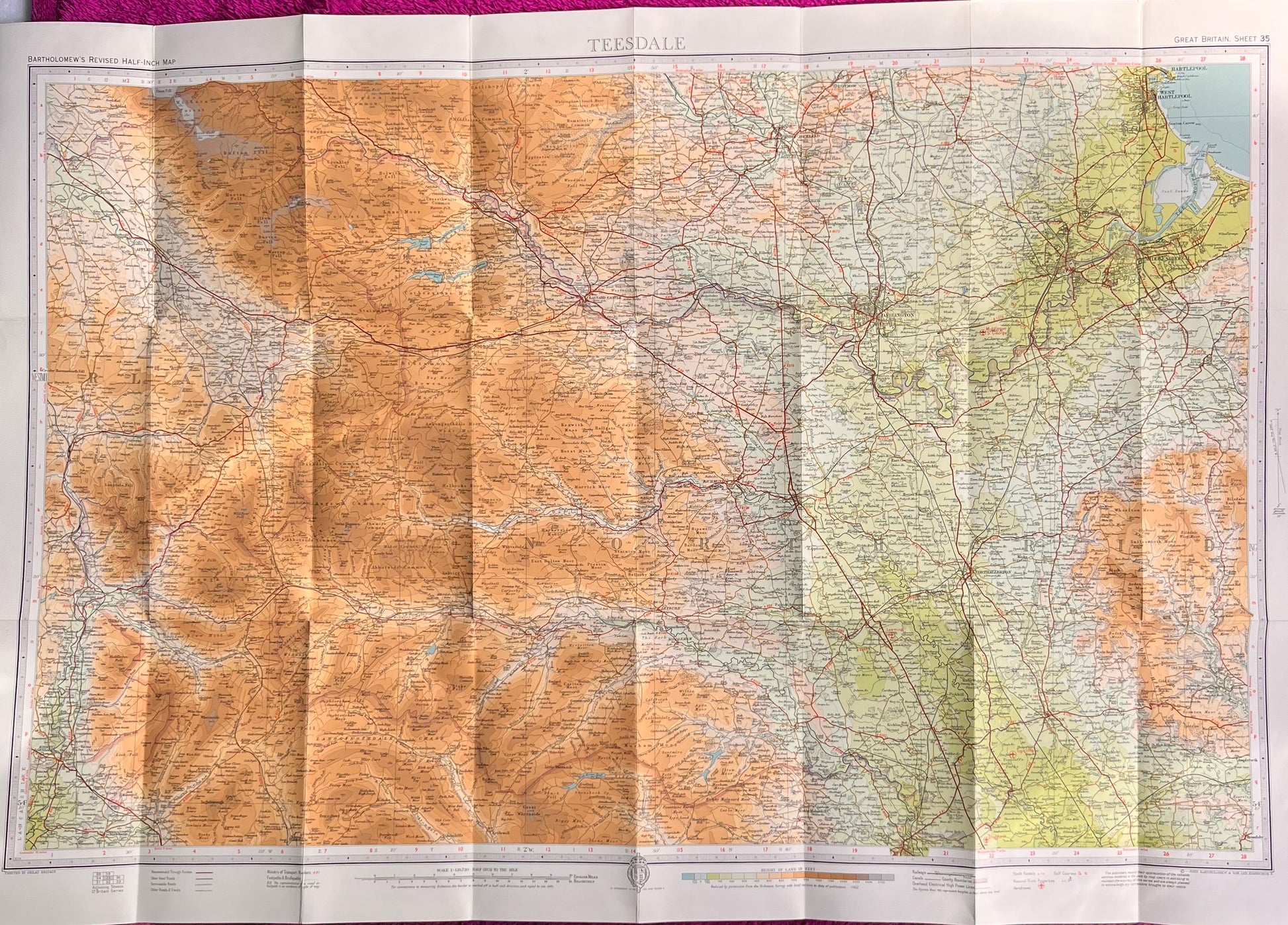

1940s Bartholomew's Map of TEESDALE (35) on Cloth
1940s Bartholomew's Map of TEESDALE (35) on Cloth
Regular price
£3.00
Regular price
Sale price
£3.00
Unit price
per
Tax included.
Shipping calculated at checkout.
Couldn't load pickup availability
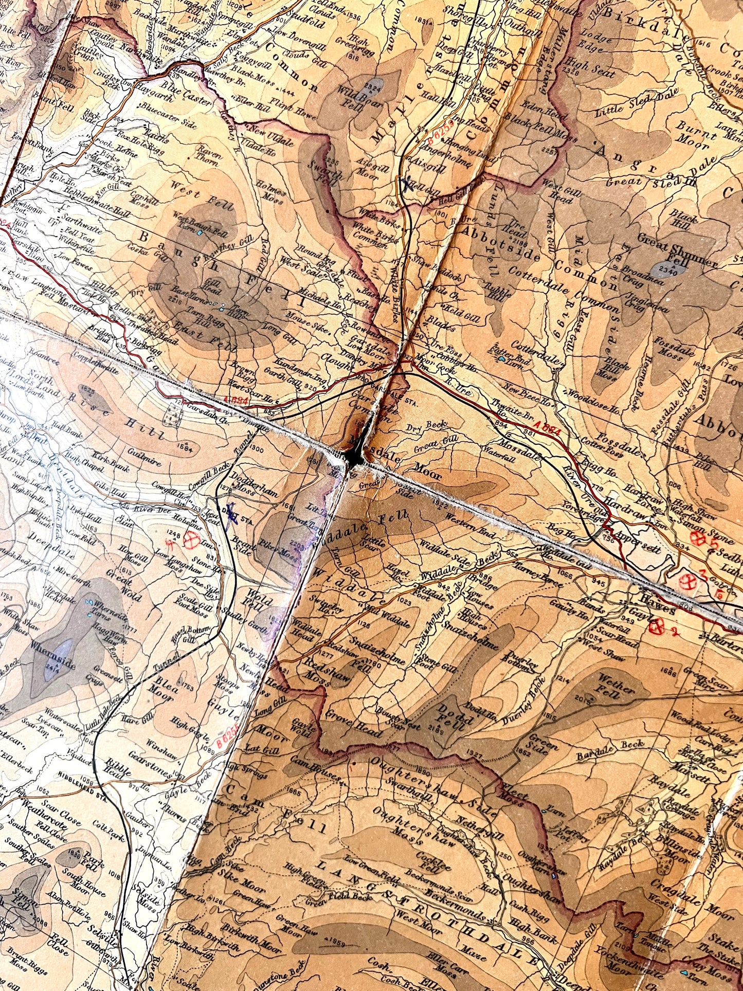
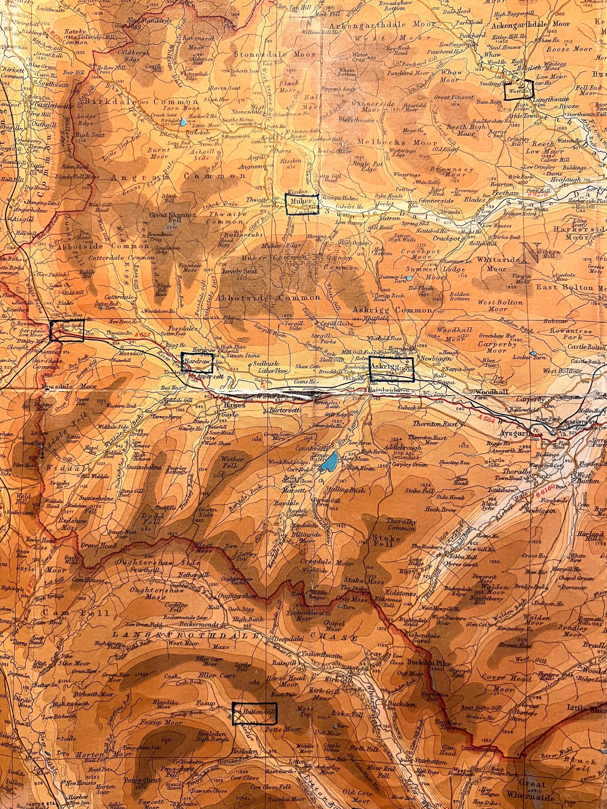
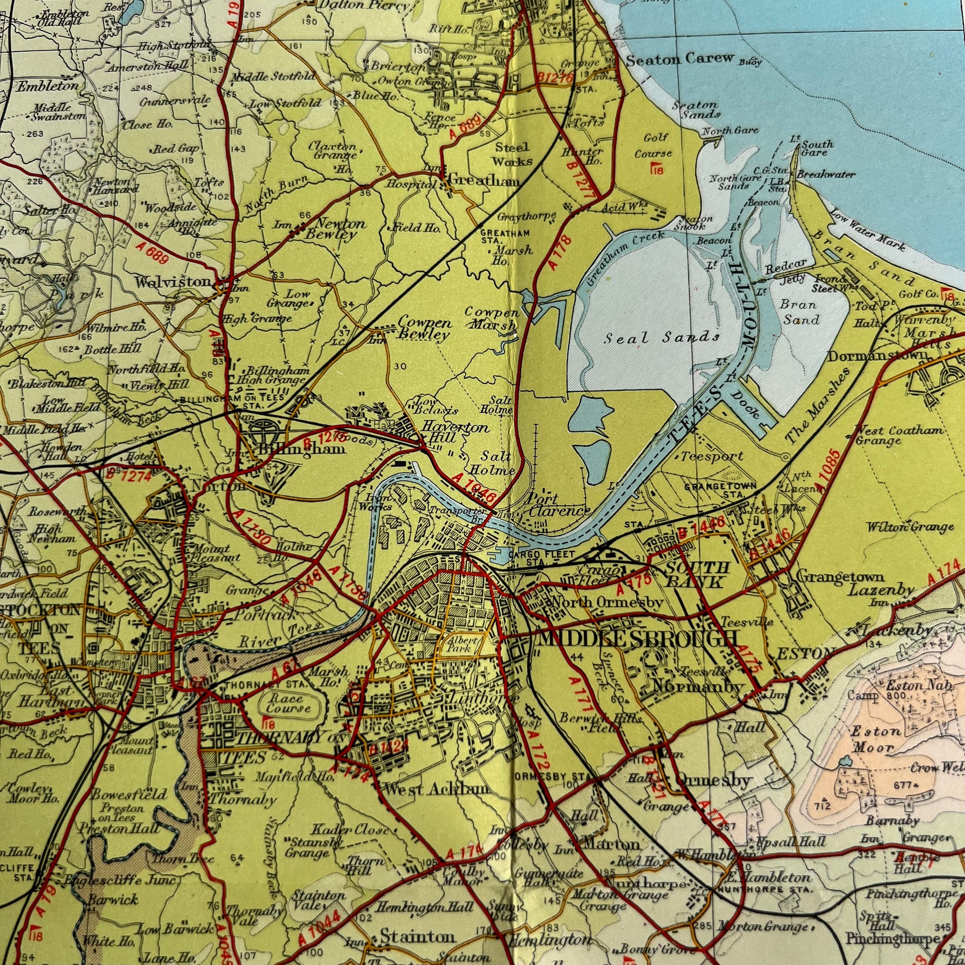
Bartholomew’s Revised "Half-Inch" Contoured Map of TEESDALE (Sheet 35)
Scale Half Inch to a Mile
Middlesbrough West Hartlepool, Darlington, Northallerton and North of Ripon, Kirby Lonsdale and Appleby in the West, Bishop Auckland in the North.
Lots of fascinating details - hospitals, industries, schools, stately homes and other long gone landmarks
I have 3 copies of these maps.
1. On cloth. Little holes at the joins on one of the folds.
2. On cloth. Revised to 1949 - some wear along folds and some ink markings on the map.
3. On Paper. Revised to 1962. Very Good Condition.