1920s Cloth Backed ORDNANCE SURVEY MAP of East Anglia 1/4" to 1 Mile Sheet 9A
1920s Cloth Backed ORDNANCE SURVEY MAP of East Anglia 1/4" to 1 Mile Sheet 9A
Regular price
£7.50
Regular price
Sale price
£7.50
Unit price
per
Tax included.
Shipping calculated at checkout.
Couldn't load pickup availability
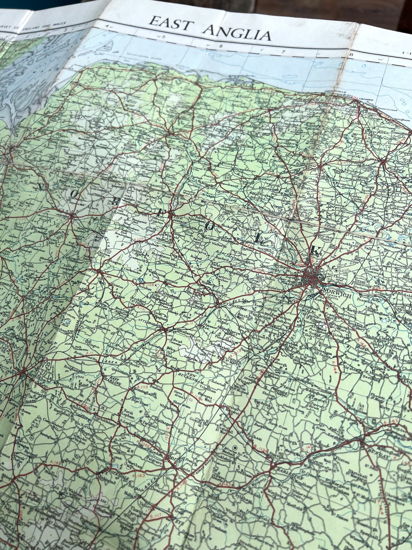
Issued in 1930 with "Roads Revised to 1927", this is an absolutely fascinating map of East Anglia in the 1920s.
And would have been very useful for the intrepid motorcyclist intently consulting it on the front cover..
It is colour coded for contours - green being the closest to sea level.
The map shows aerodromes, windmills, railways, and no motorways at all !The scale is 1/4 inch to 1 mile and it is on cloth .
There is a little wear along some of the folds