-
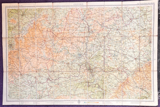
1930s/40s Bartholomew's Map of OXFORD Sheet 14
Regular price From £3.50Regular priceUnit price per -
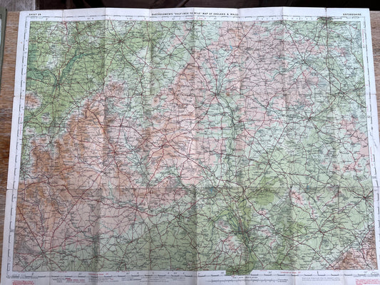
Early 1940s Map of OXFORDSHIRE on Cloth
Regular price £6.00Regular priceUnit price per -
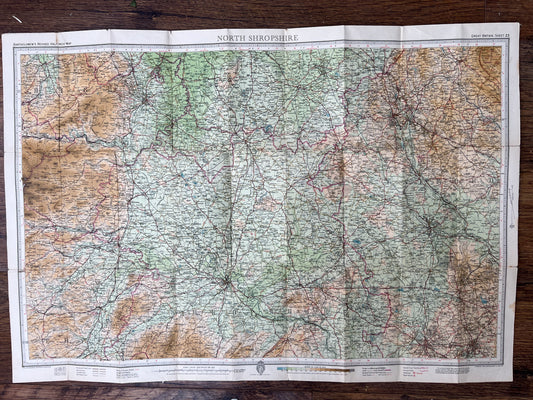
1940s/50s Bartholomews Map of N. SHROPSHIRE on Cloth ((Sheet 23)
Regular price £6.50Regular priceUnit price per -
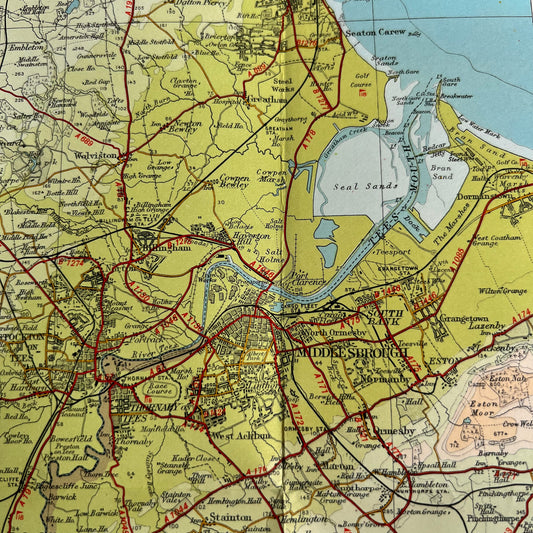
1940s Bartholomew's Map of TEESDALE (35) on Cloth
Regular price From £3.00Regular priceUnit price per -
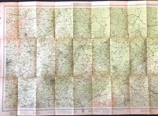
1940s Bartholomew's 1/2" to 1 Mile Contoured Map of CAMBRIDGESHIRE
Regular price From £3.00Regular priceUnit price per -
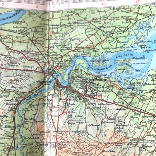
1940s Bartholomew's 1/2" to 1 Mile Contoured Map of KENT
Regular price From £4.00Regular priceUnit price per -
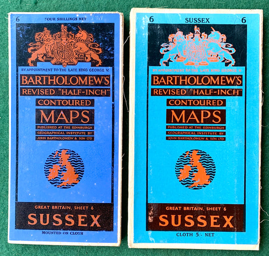
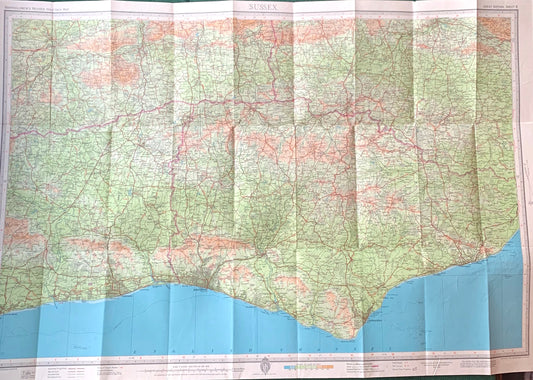
Sheet 32 Sussex 1930s to 1950s Bartholomew "Half-Inch" Contoured Maps incl Brighton, Tunbridge Wells, Hastings
Regular price From £4.00Regular priceUnit price per -
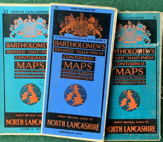
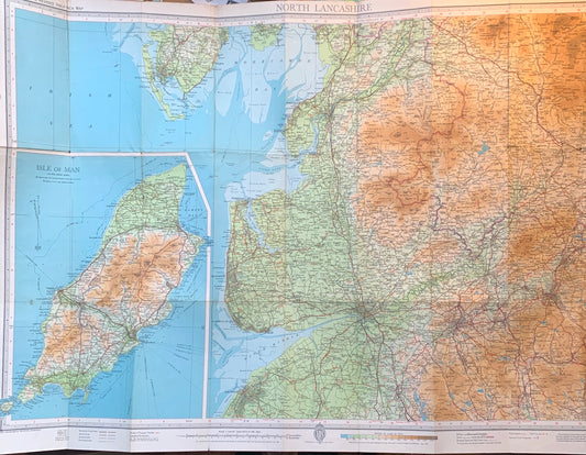
1940s & 1950s Cloth Mounted Maps of North Lancashire Sheet 31. Incl. isle of Man, Preston, Blackpool, Rochdale, Southport.
Regular price From £3.50Regular priceUnit price per -
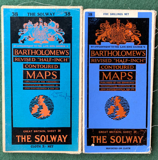
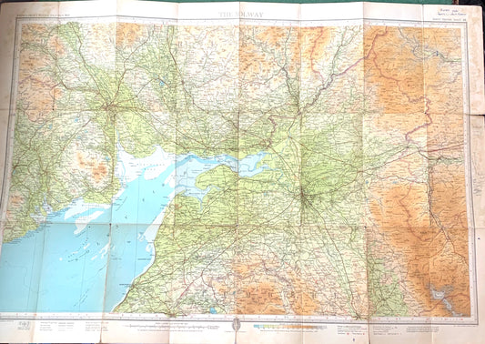
The Solway 1940s & 1950s Cloth mounted Maps Sheet 38. Incl. Carlisle, Penrith, Dumfries.
Regular price From £5.00Regular priceUnit price per -
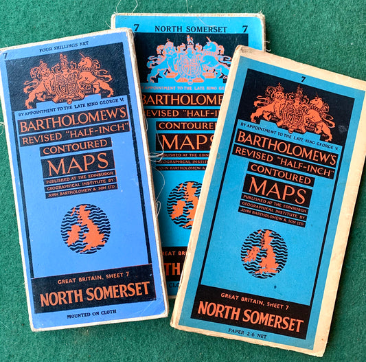
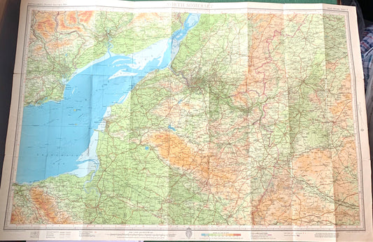
1940s, 50s Maps of North Somerset Sheet 7. Incl. Bristol, Cardiff, Devizes
Regular price From £2.00Regular priceUnit price per -
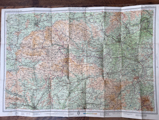
1940s/60s Bartholomew's Map of SALISBURY PLAIN incl. Reading, swindon, Newbury etc
Regular price From £4.00Regular priceUnit price per -
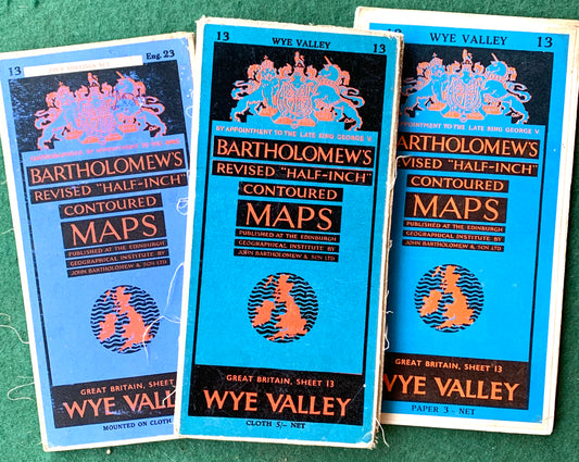
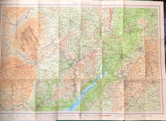
Detailed 1940s to 60s Maps of Wye Valley incl. Cheltenham, Gloucester, Stroud.
Regular price From £4.50Regular priceUnit price per -
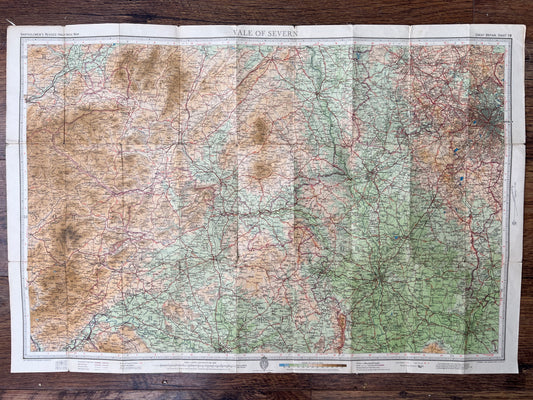
1940s/60s Bartholomew's Map of VALE of SEVERN incl. Worcester, Kidderminster etc
Regular price From £4.00Regular priceUnit price per -
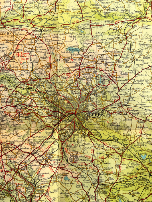
1950s Bartholomew's Map of Wharfedale
Regular price From £2.00Regular priceUnit price per -
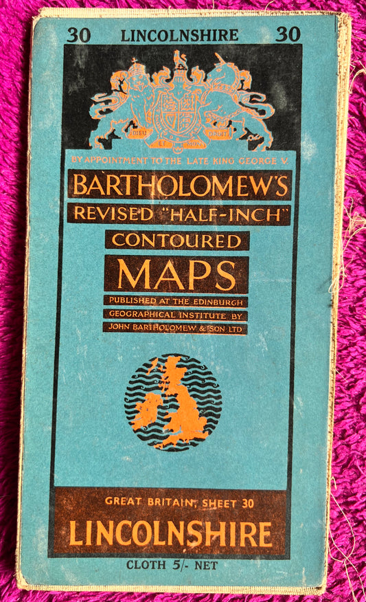
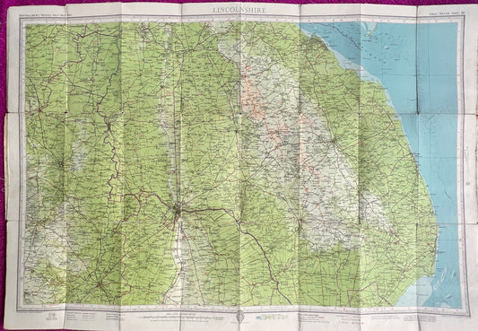
1950s Bartholomew's Map of Lincolnshire Sheet 30 on Cloth
Regular price From £2.00Regular priceUnit price per -
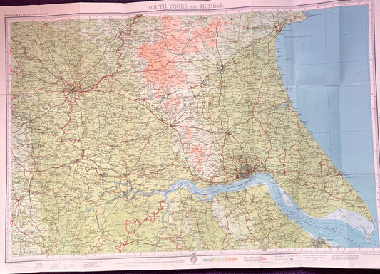
1952 Bartholomew's Map of S YORKS & HUMBER on Cloth
Regular price £7.00Regular priceUnit price per